Swept Path DXF & DWG Export: From Any Site Plan into AutoCAD

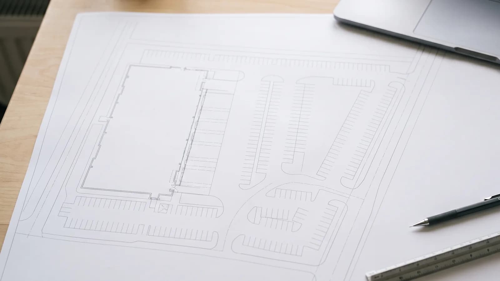
A swept path check in the browser is quick, but the check is not the deliverable. The deliverable is a drawing: the maneuver, the envelope and the vehicle placed correctly in the site plan your office already maintains in CAD. That last step is built in: PathSweeper exports every calibrated project as a DXF or DWG file, and a placeable reference point lets you drop that export into AutoCAD, BricsCAD or Allplan exactly where it belongs.
DXF export now works for every calibrated project
Until now there was a gap that users ran into regularly: if your site plan came in as a PDF or an image, the finished analysis could only leave the tool as an image. A picture of a swept path is fine for a quick email, but you cannot snap to it, measure it, or lay it into an existing CAD drawing as real geometry.
That restriction is gone. Any project with a calibrated scale can export a DXF, no matter how the plan came in: PDF, JPG, PNG, a satellite view, or a CAD file. Calibration is the one requirement, because the DXF is written in real-world millimeters. If you calibrated your plan against a known dimension, the exported envelope is true to that scale, and a 2.55 m wide truck measures exactly 2550 mm when you check it with the measure tool in CAD.
One thing the DXF deliberately does not contain is the site plan itself. You get the analysis as clean vector layers, meant to land in the drawing you already have, not a rasterized copy of your own plan. Which raises the obvious question: how do you get it into position?
The reference point: land the export exactly where it belongs
Before exporting, you can now place a reference point anywhere on your plan. Pick a spot you can also identify in your CAD drawing, a building corner, a boundary marker, an axis intersection. Two things happen:
- The exported DXF is shifted so this point becomes origin (0,0).
- The point is drawn on its own layer as a red crosshair and circle, labeled REFERENCE POINT (0,0), so you can see it in CAD.
In your CAD application you insert the DXF, grab it at the marker, and move it onto the same known point in your drawing, with object snap doing the precision work. No scaling, no guessing, no aligning a screenshot by eye. The marker on the canvas is a one-to-one preview of what lands in the file, so what you see while placing it is what you get in CAD.
What is inside the DXF
The export is organized in named layers, so you can switch parts of the analysis on and off in CAD like any other reference:
- PATHSWEEPER_SWEPT_AREA: the swept envelope, in the color you gave the path
- PATHSWEEPER_PATH: the front-axle centre line in green
- PATHSWEEPER_VEHICLE: vehicle outlines with wheel positions at the start and end of each path
- PATHSWEEPER_NODES and PATHSWEEPER_LABELS: segment markers and vehicle names
- PATHSWEEPER_INFO: a data sheet block outside the drawing area, listing length, width, wheelbase, overhangs and outer turning radius for every vehicle used
- PATHSWEEPER_REFERENCE: the reference point marker
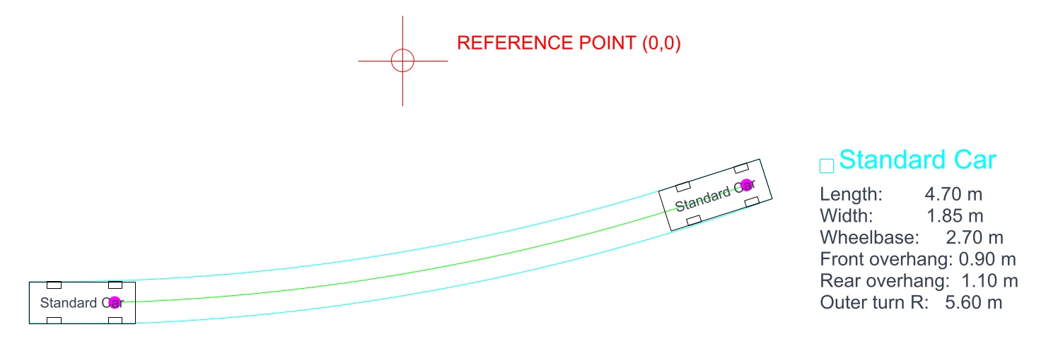
Rendered straight from an exported DXF file, not a screenshot of the app: envelope, centre line, vehicle positions, data sheet and the reference point marker at origin (0,0).
The file is written in the AutoCAD 2013 DXF format (AC1027) and passes strict DXF validation, so it opens in any application that reads DXF, for example AutoCAD, Civil 3D, BricsCAD, Allplan, QGIS or LibreCAD.
DWG export
If your office's deliverable standard says DWG rather than DXF, there is no conversion detour: DWG is a format of its own in the Export dialog. Choose DWG and the same swept geometry, the same layers and the same reference-point origin are converted server-side and downloaded as an AutoCAD 2000 (AC1015) DWG, a version every current CAD application reads. Nothing about the workflow changes; exports with several paths arrive as one ZIP of DWG files.
DXF remains the right choice when you want the open exchange format or need to feed tools like QGIS; DWG is for offices whose deliverable standard simply says DWG. Both are part of the same Projekt Pass.
From PDF site plan to CAD drawing in five steps
- Open the free tool in your browser and upload your site plan. PDF and images work directly; DWG and DXF plans are converted automatically during upload (part of the Projekt Pass).
- Calibrate the scale against a known dimension, as described in the swept path analysis guide.
- Pick a design vehicle and drive the maneuver. The swept envelope updates in real time.
- In the Export dialog, place the reference point on a spot you can also find in your CAD drawing.
- Export the DXF or DWG, insert it in CAD, and snap the marker onto the known point.
Honest limits
A few things worth knowing. Vehicle outlines are drawn at the start and end of each path, not at every intermediate step, which keeps the file readable as a drawing. Articulated vehicles (semi-trailers, truck-and-trailer combinations, articulated buses) export like any other vehicle. And it is a paid feature: DXF and DWG export are part of the Projekt Pass, a one-time payment per project, while the analysis itself and PNG/JPEG export remain free. There is no subscription. What the other packages charge for the same export step is in our swept path software roundup. And if the sheet itself, not the CAD file, is the deliverable, the tutorial on creating a swept path diagram without CAD walks through the free image export step by step.
Bottom line
The browser is the right place to test whether a vehicle makes the turn. CAD is the right place for the result to end up. With DXF and DWG export for every calibrated project and a reference point that makes placement exact instead of approximate, PathSweeper now covers the full loop: check the maneuver in minutes, then hand your CAD drawing real geometry, in scale, in position.